
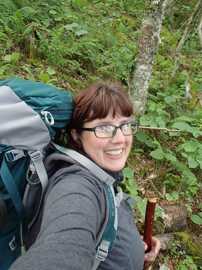
We took trails to Deep Gap and hiked the AT back to the 603.
We also did parts of the Horse Trail and the 1.32 mile side trail to the top of Mt. Rogers
All total, 28 miles!

We parked at Grindstone Campground, the Mt. Rogers trail starts right in the campground loop.
It was $5 a night to park, but knowing it's patrolled and the gate is locked at night was of comfort.
There's a free parking area at the AT trailhead 3 miles away and lots of cars were parked there. I saw no glass on the ground and in fact, we slept there in the van the 3rd night with no problems. It's within sight of a busy horse camp. I would feel okay parking there, but will likely still pay to park somewhere to keep that 'but what if' out of my head.


after 2 hours of steady climbing, we took a break

the trail leveled off some and we started looking for our campsite.
We set up off the trail near a little stream and both slept well and warm!
We'd wished for the hammocks, but the wind was high and the tent was snug, so it worked out.
Day Two


I LOVE this backpacking pillow, it's huge and it stays in place.
When one of ours kept going flat, the company sent another, no problem.

A new thing I tried this trip. Not the best tasting, but pretty good fizz!

Our little site.

The trail and stream shared space more than once!


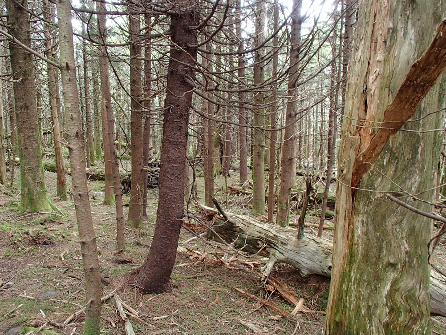
Loved the trees all the way along the trail. The higher we went, the more birch we saw.


One of the rare times Chan was behind me!

It didn't last long.
There were times I thought I was rocking the hiking and she'd be so far ahead that it would be half an hour between sightings and that was only if she sat down and waited. ACK

Goodbye, Legs McGillicutty!


She hiked the whole day in her down jacket!

I really, really hate steps on a trail, it adds 100% more effort to lift and pull yourself and 25 pounds of gear up!

More, ack!
This is Deep Gap, the junction of the Lewis Fork and AT

More rocky uphill, but it really wasn't too hard at all.

A tunnel-light

BAM, nothing but view.

BAM

BAM!


The trees were like NPC on our quest. Vital to the story but stuck in place.


We dropped our packs at the base of the Mt Rogers trail and walked up. It's steep and there's no view, but WOW. The forest is out of Transylvania or Canada or someplace haunted.


It's another highest point in a state for us!
That's 10 so far!

Chan over at the left, taking it all in.

Mt Rogers
Thomas Knob Shelter is over at the right, but it was PACKED, we moved on through fast. The group there was none too welcoming and were all 20ish males and one VERY LOUD female. I don't know why women do that! Nothing screams, "I am insecure" like screeching.


We climbed up off the trail to a big rock-something we did all day long-and Chandler went to look over the ledge and there were PONIES! We were so excited!

We crashed for a rest, but it was chilly!

We passed through these horse gates the whole day.


The aptly named Rhododendron Gap!


Yes, the trail goes up a cliff. ACK.

Frequently, I would look off and discover Chan up a rock, looking at the view some more.


We discussed camping in this crevasse to be out of the wind!

No horses, SO SAD
But then, not 1/4 mile away:


Ponies! They make everything better.

They put the trail on the rockiest part possible.


People do pet and even feed the ponies, but the ponies can and do bite and kick. We gave them lots of space, letting them choose how close to come to us.


This has been our year for seeing the most adorable wild babies!


I look for faces when I hike, they generally give me an idea of how the day will go. It's very accurate, but then again, I am probably just suggestible. Still, I am always happy to see faces that look hopeful. This one looks like, "Well, at least it's pretty!"


The 500 mile mark on the AT.
THAT IS CRAZY.
The rocks are so bad, there's no part of me that thinks hiking 500 miles on them would be fun.

Blessed, blessed DIRT

Where we just were


gaaaaaaa
The dirt didn't last long!

Our goal for the day-the creek!

We set up not far away and aired socks and washed out bras and liners before getting in bed.
The whole day the balds were chilly cold, 53. The wind was cutting, it felt GREAT hiking, like working out in front of the AC. But we were a little worried about at night.
Camping in the trees was perfect, light wind and it was snug once again
DAY THREE:

I slept 13 hours. Solid.
YEAH
We got pretty good at packing up camp, but I have zero desire to try it in the rain-look how much mesh the tent has!

Chandler said this face was up for interpretation.

Oh, rocks.

It's a compulsion, I don't think she can NOT climb a rock near the trail.

Wise Shelter

This is granola with vanilla protein powder and flax seeds that I mixed with cold water and ate with my Nutella spoon. It was VERY filling, I didn't eat again all day.

The alternate to weaving through the fence gates

It's very high!

Rocks

Shifty rocks, the WORST TYPE

Another threading gate

Another log book signed!

We had 2 maps, but I took a pic of this one, too.
The area is riddled with trails, it would be possible to backpack a full week just zigzagging


sticky mud!
Suddenly, I was missing the rocks, hahahaha


The balds were covered in blueberry, blackberry, strawberry, flame azaleas, rhododendron, cinnamon fern, laurel and little trees.


I saw a zillion heart shaped rocks, but this one was high contrast, so I snapped a pic!


Fern Fairy Ring!

Walking on the VA Horse Trail a while.

Gorgeous break spot!

We eventually turned back and got back on the AT where we got off. We just wanted to see how the other trail looked.


Old Orchard was our goal. The van was 3 miles away from the 603 crossing, so it seemed like a good break point. It would give us about 9 miles for the day from the creek about a mile from Wise Shelter to Old Orchard adding in the couple of miles we did on the Horse Trail.


ahhhhhh! What did that?

Oh the rocks.

The shelter!


hehehehe
We hung out about 15 minutes, topped off our water and decided to keep going. There was a group camping and they were well on the way to drunk and again-screeching loud girls.
We thought we'd set up between the shelter and the road, but it was less than 2 miles, so we just went to the trailhead at 603 and took stock. We could keep going on the AT to the next shelter and loop back the next morning via horse trails, take a trail and road walk back to the van or head to the horse camp and see if we could set up nearby. There were dozens of women, so it felt like a safe option compared to setting up on our own so near a road.
If at all possible, never camp (alone) within 2 miles of a road. If there's going to be any trouble on the trail, it's near civilization.
If at all possible, never camp (alone) within 2 miles of a road. If there's going to be any trouble on the trail, it's near civilization.


We decided to go on to the van, just 3 more miles away.
Hammocks and Taco Bell were the lure!
Hammocks and Taco Bell were the lure!


We hiked the Fairwood Valley (I think that's the name!) Trail and it was ALL UP HILL
I think it was the hardest part of the whole hike, I was tired.
But first, we had to cross 2 cow pastures and it was scary! hahaha. And muddy as heck, we both were SO glad to have on gaiters the whole hike. Between gravel, mud, blackberry and other brush, having that extra lower leg protection was nice.
But first, we had to cross 2 cow pastures and it was scary! hahaha. And muddy as heck, we both were SO glad to have on gaiters the whole hike. Between gravel, mud, blackberry and other brush, having that extra lower leg protection was nice.


We went to eat hot food and got back to the campground after the gate was locked, so we drove back to the trailhead and slept on our pads in the back of the van.
It was fine, though someone else had the same idea-to pull in and sleep-and I had a few minutes of wondering if they were nefarious. I quickly realized they were crashing on the ground by their truck and not looking for hide a keys (which was my first thought when I saw a guy on his back shining a light under a parked vehicle) and went back to sleep.
It was fine, though someone else had the same idea-to pull in and sleep-and I had a few minutes of wondering if they were nefarious. I quickly realized they were crashing on the ground by their truck and not looking for hide a keys (which was my first thought when I saw a guy on his back shining a light under a parked vehicle) and went back to sleep.
DAY FOUR:

Picnic area at Grayson Highlands State Park
We had the whole day to kill time, Matt and Ben were coming up for the weekend!
We had planned to take most of Friday getting back to the campsite to meet them, but our powerlegs powered us through a day early.
We had planned to take most of Friday getting back to the campsite to meet them, but our powerlegs powered us through a day early.

We had lunch at the Creeper Trail Cafe and got slices of the World's Best Chocolate Cake.

Chan got onion rings.
(they fried my tots and her rings in the same oil, so I had a horrid bellyache all afternoon and overnight. UGH)
(they fried my tots and her rings in the same oil, so I had a horrid bellyache all afternoon and overnight. UGH)
We went to Damascus and spent $10 on a blister kit at the outfitters, out of nowhere my boots were shredding my heel up. Chan's knees were both hurting.
We called Matt to see where he was and he was stuck in Chattanooga traffic, so we decided to drive his way and just meet up at Tellico Plains, which has long been our go-to place to just take it easy.
He arrived first and got us a site at Indian Boundary and we met up at The Beach and had grilled cheese and shared our cake.

At camp, these two caught up and we all walked the 3.1 mile lake trail loop before bed.


The campground was noisy until 11 or so. Some kids were playing Cornhole and it sounded like wood chopping. There were campfires galore and smoke, people drove around in stinky exhaust trucks and the bathhouse was across the road and the door went SLAM on the men's room side. We left early Saturday and in the end, opted to head on home (after a stop at the book store and Tellico Grains, of course!).
Chan needs a smaller pack, I need new shoes and we both were more beat up than we realized.
Still, it was an awesome trip, I am so glad we got to go and that despite the rough trail, Chan's first multi-night trip was such a success. We are already planning the next time!
No comments:
Post a Comment